this big river
snakes its way
out of colorado
all the way
to the gulf of mexico

From wikipedia
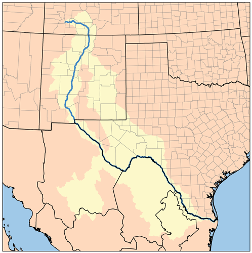
Known as the Rio Grande in the United States and as the Río Bravo (or, more formally, the Río Bravo del Norte) in Mexico, this river, 1,885 miles (3,034 km) long, is the third longest river system in the United States[1] and serves as a natural boundary along the border between the U.S. state of Texas and the Mexican states of Chihuahua, Coahuila, Nuevo León, and Tamaulipas.

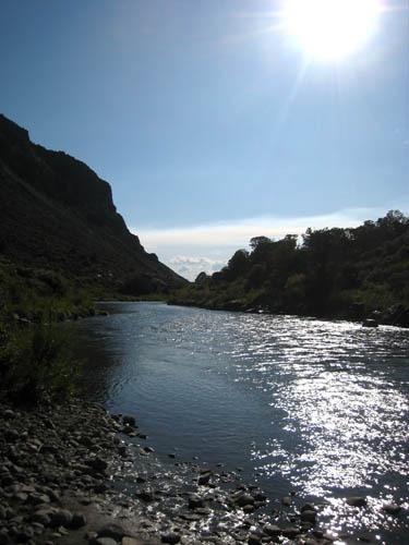
just outside taos new mexico
Description
The Rio Grande rises in the east Rio Grande National Forest in the U.S. state of Colorado. It is formed by the confluence of several streams at the base of Canby Mountain, just east of the continental divide. From there, it flows through the San Luis Valley, then south into New Mexico through Albuquerque and Las Cruces to El Paso, Texas, where it begins to form the border between the U.S. and Mexico. A major tributary, the Río Conchos, enters at Ojinaga, Chihuahua, below El Paso, and supplies most of the water in the 1,254 miles (2,018 km) Texas border segment. Other known tributaries include the Pecos and the smaller Devils, which join the Rio Grande on the site of Amistad Dam. Despite its name and length, the Rio Grande is not navigable by oceangoing ships, nor are there smaller craft using it as a route. In fact it is barely navigable at all. Its natural flow is only 1/20 the volume of the Colorado River, and less than 1/100 that of the Mississippi.[citation needed]
The river has, since 1848, marked the boundary between Mexico and the United States from the twin cities of El Paso, Texas, and Ciudad Juárez, Chihuahua, to the Gulf of Mexico. As such, it was across this river that Texan slaves fled when seeking their freedom, aided by Mexico's liberal colonization policies and abolitionist stance.[2]
The major international border crossings along the river are Ciudad Juárez and El Paso; Presidio, Texas, and Ojinaga, Chihuahua; Laredo, Texas, and Nuevo Laredo, Tamaulipas; McAllen-Hidalgo, Texas, and Reynosa, Tamaulipas; and Brownsville, Texas, and Matamoros, Tamaulipas. Other notable border towns are the Texas/Coahuila pairings of Del Rio–Ciudad Acuña and Eagle Pass–Piedras Negras.
The US and Mexico share the waters of this river under a series of agreements administered by the joint US-Mexico Boundary and Water Commission. The most notable of these were signed in 1906 and 1944.

a huge gigantic snake seen along the rio grande
you hear all sorts
of storys about
dont drink the water or eat the fish
south of the headwaters
cuz folks dump crap in the river
we got lots of meth dealers in new mexico
and so
we need a rebirth of the river

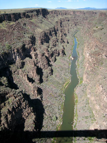
looks like a big green snake dont it?
The Rio Grande Gorge Bridge is a cantilever truss bridge across the Rio Grande Gorge 10 miles (16 km) northwest of Taos, New Mexico, United States. At 650 feet (200 m) above the Rio Grande, it is the third highest bridge in the United States, after the Royal Gorge Bridge (1053 ft) over the Arkansas river in Colorado and the New River Gorge Bridge (876 ft) over the New River in West Virginia.[citation needed] The span is 1,280 feet (390 m): two 300-foot (91 m)-long approach spans with a 600-foot (180 m)-long main center span. The bridge was dedicated on September 10, 1965 and is a part of U.S. Route 64, a major east-west road.
In 1966 the American Institute of Steel Construction awarded the bridge "Most Beautiful Steel Bridge" in the "Long Span" category. The bridge has appeared in several films, including Natural Born Killers. The bridge has been the site of several suicides.

ouroboros(2008 oily painting)
The Ouroboros often represents self-reflexivity or cyclicality, especially
in the sense of something constantly re-creating itself, the eternal return